Natural attractions are scattered all over the planet and attract tourists, no less than museums and architectural sites of antiquity. In the list of the most visited objects, lakes occupy the leading positions. Picturesque corners of the Earth are pleasing to the eye and allow you to relax in the lap of nature. Some are impressive in their size and resemble the sea, since it is not possible to see the opposite shore.
Lakes are also a source of fresh water, vital arteries of their regions. There may be nature reserves near them, enterprises nearby may be built, and excursion tours may be organized. Economy and tourism are often directly related to lakes and their surroundings. As for the ecological component, a lot of attention has also been paid to it in recent decades.
The largest lakes on earth by area
List, photo with names and descriptions
Caspian Sea
It is located on the territory of five states at once, including Russia. The water is brackish. Five rivers flow into it. The water level fluctuates at around 27 meters below sea level. There are large peninsulas and about fifty islands of varying sizes. On the coast there are port and resort towns, as well as smaller settlements. The animal and plant worlds are diverse. The climate and water temperature are changeable.
Area - 436,000 km².

Upper
Located in the United States and Canada, it is part of the Great Lakes system. Of the fresh, it is the largest in the world. The Nipigon River flows in, St. Mary's flows out. The depth is impressive and in some places reaches four hundred meters. Although temperatures are low, the surface is not covered with ice even during the winter, unlike the coastline. There are several ports. There are many relatively rare fish species in the local waters.
Area - 82,100 km²

Victoria
Located on the territory of three South African countries. The average depth is about forty meters. Fresh water. Since 1954, when the dam was built, it has actually been turned into a reservoir. There are many small islands. The Kagera river flows in, the White Nile flows out. Average air temperature in the lake area: + 20- + 22 ° C. There are two rainy seasons in a year. Fishing and an increase in the population on the coast have led to a deterioration of the ecological situation.
Area - 68870 km²
Huron
Located in the United States and Canada, it is part of the Great Lakes system. The Makino Strait connects it to nearby Lake Michigan. The St. Mary's River flows in, St. Clair flows out. The average depth is within sixty meters. There are many islands and bays. Since the middle of the last century, the fish population has been recovering, fry are released, and representatives of the authorities are closely monitoring the ecological background.
Area - 59,600 km²

Michigan
The only Great Lakes system located entirely in the United States. The Makino Strait connects it to the neighboring Lake Huron. The maximum depth is 281 meters. Height above sea level - 177 meters. For four months a year, the surface is covered with ice. There are quite large islands, and there are several cities on the coast.
Area - 58,000 km²

Tanganyika
Located in four countries in Central Africa. The longest freshwater lake on the planet. Included in the Congo Basin. The depth at the lowest point reaches 1470 meters. Surface water temperature - from + 24 ° C. The fauna is represented by two thousand species, of which almost a third lives in a limited range. Fishing and waste dumping in the northern part of the lake have resulted in pollution.
Area - 32600 km²

Baikal
Located in Russia. The deepest lake on the planet and also the largest reservoir of fresh water. Many rivers flow in, but only one flows out - the Angara. In the winter-spring period, the surface is almost completely covered with a thick layer of ice. There are 27 islands. The flora and fauna are represented by several thousand species, half of which have a limited distribution area.
Area - 31500 km²

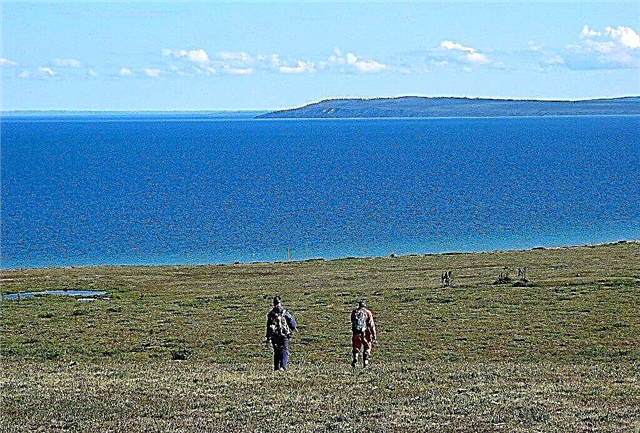
Big Bear Lake
Located in Canada at the Arctic Circle. The average depth is 72 meters. The air temperature in the area is mostly below zero, although in the middle of summer it can reach + 12 ° C. Ice on the surface is a familiar sight in these places. There is only one settlement on the coast. Previously, a uranium deposit was developed nearby, but it was closed due to the high cost and complexity of mining.
Area - 31,000 km²

Malawi (Nyasa)
Located in three countries in East Africa. Its ecosystem is unique, most of the plants and animals are found only here in the surrounding areas. The average depth is a little less than three hundred meters. Part of the basin is covered with mountains and highlands. 14 rivers flow, and only one flows out - the Shire. There are settlements along the coast, but there are not many of them. Fishing is active.
Area - 29,500 km²

Great Slave Lake
Located in Canada. Deepest in North America. Several rivers flow in, followed by Mackenzie. The average depth is 41 meters. Eight months a year, its surface is covered with ice. In winter, it is so durable that trucks with goods and necessary materials for the nearby diamond mines go around the lake. The western coast is covered with forests, and the eastern one is covered with tundra.
Area - 27,000 km²

Erie
Located in the United States and Canada, it is part of the Great Lakes system. Erie is an important part of agriculture in both countries. The distance to the lowest point at the bottom is 64 meters. The surface is covered with ice for several months. Since the beginning of the 70s of the last century, the authorities have taken up the ecology of the region, which contributed to a change in the situation for the better.
Area - 25,700 km²

Winnipeg
It is located in Canada and is part of the reservoir of the same name. The average depth is 12 meters. Height above sea level - 217 meters. Several rivers flow in, followed by Nelson. Towns and villages are located around. Many wild islands. There are caves and rocks along the coast. The taiga forests growing on the eastern coast are protected by UNESCO.
Area - 24514 km²

Ontario
Located in the United States and Canada, it is part of the Great Lakes system. Its water area includes Finger Lakes. The average depth is 86 meters. The flowing river is Niagara, the flowing river is St. Lawrence. Through canals connected to the Hudson and Erie. Shipping is developed and active, there are many ports. Large settlements, including Toronto, are located on its shores.
Area - 18960 km²

Ladoga lake
Located in Russia. The largest freshwater in Europe. Many rivers flow in, but only one flows out - the Neva. In its water area there are natural attractions of various types, including the Nizhnesvirsky reserve. There are also architectural monuments. And also memorials. Among the islands, Valaam is better known than others. Shipping is well developed, it is used in economic activities and tourism.
Area - 18130 km²

Balkhash
Located in Kazakhstan. Part of the reservoir is freshwater, part is with salt water. These zones are separated by a narrow strait. Several rivers flow into it. The average depth is less than six meters. From each of the four cardinal points of the world, the lake is surrounded by different types of terrain. East - sandy massif, west - desert, south - mountains, north - steppe. The fauna is scarce both in species and in total.
Area - 16400 km²

East
Located in Antarctica. The largest of the under-ice. The Russian station of the same name is located nearby. The absolute depth is over 1200 meters. The water temperature reaches + 10 ° C, heating comes from geothermal underground sources. It took a decade to get to the lake, making accurate calculations and drilling a well. Research on water and microorganisms living in it continues.
Area - 12,500 km²

Lake Onega
Located in Russia.Many rivers flow into the water area, there are more than one and a half thousand islands in the water area. The average depth is 30 meters. Some of the banks are swampy, some are covered with taiga forests. There are two ports and several settlements of different status. There are many fish, including rare species. Since industrial enterprises are located on the lake, the ecological state of the territory is deteriorating.
Area - 9720 km²

Titicaca
Located in Peru and Bolivia. The largest in terms of fresh water reserves in the region. There are several towns and villages on the coast, there are settlements of aborigines who have preserved many traditions, including economic ones, of their ancestors. Shipping is well developed. The average depth is 107 meters. Height above sea level - 3812 meters. About three hundred rivers flow in, and only Desaguadero flows out.
Area - 8372 km²

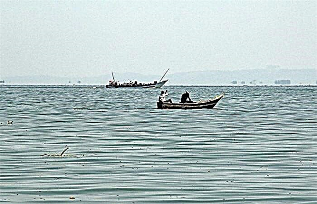
Nicaragua
Located in the country of the same name. Among the freshwater ones, this is the only place where you can meet sharks. The average depth is 13 meters. Large waves appear on the surface, sometimes storms occur. The islands are numerous, united in groups. The Tipitapa river flows in, and San Juan flows out. Nicaragua is connected to the Caribbean Sea through a shipping channel. A canal is also being built between the oceans, which will pass through the lake.
Area - 8264 km²

Athabasca
Located in Canada. The greatest depth is 124 meters. The Slave and Mackenzie rivers flow out, and the Athabasca flows into it. Deposits of uranium and gold were discovered on the shore, which led to the emergence of mines and active mining, but in the early 80s of the last century, the work was curtailed. There are sand dunes on the southern coast. More than twenty species of fish are found in the lake.
Area - 7850 km²

Taimyr
Located in Russia on the peninsula of the same name in the Arctic Circle. Climatic zone - tundra with some areas of permafrost. Several rivers flow in, and the Taimyr River flows through it, which has an addition to the name "Upper" and "Lower", depending on its position. Arctic fish are found in the waters of the lake, the fauna is represented by a very small number of species.
Area - 6990 km²

Turkana
Located in Kenya and Ethiopia. Has a second name - Rudolph. There are three islands in its water area. Several rivers flow in, not a single one flows out. It is famous for its crocodiles, which are impressive in size and numerous. Important archaeological finds related to ancient people and the geography of the area were made in the district in different periods.
Area - 6405 km²

Raindier lake
Located in Canada. The origin is glacial. The average depth is 17 meters. From late spring to early summer, the surface is covered with ice. The lake became the venue for sport fishing competitions. The coast is sparsely populated. One of the natural attractions is Gluboka Bay, which was formed due to the fall of a meteorite one hundred million years ago.
Area - 6330 km²

Issyk-Kul
Located in Kyrgyzstan. The height above sea level is over 1600 meters. The water is brackish. The lake is closed, and flows into it about eighty tributaries. There are four bays, each in use but not active. The climate is mixed - sea and mountain, which attracts tourists. Coastal settlements vary in size, but there are quite a few of them.
Area - 6200 km²

Urmia
Located in Iran. The largest lake in the Middle and Near East. The water is salty. The lake is closed. The greatest depth is 16 meters. There are more than a hundred islands, some of them have pistachio forests. The surface does not freeze. Shipping is developed and active. The appearance of a dam in 2008 divided the water area into two parts and negatively affected the environment.
Area - 6001 km²

Venern
Located in Sweden. The largest in the country. From December it is covered with ice, it is on the surface until mid-spring, but the layer is not thick and periodically thaws. The average depth is 27 meters. There are small islands in the water area, there are three large ones. They, like the lake, are included in the national park. About 30 rivers flow in. Large ports are used all year round. Fishing is developed.
Area - 5545 km²
Winnipegosis
Located in Canada. The average depth is about 12 meters. The absolute height above sea level is 254 meters. There are three large settlements on the coast. Fishing is developed. There are enough fish species, but the emphasis is on trout. Since there were some problems with the environment, the authorities have created two wildlife sanctuaries in the district and are engaged in the restoration of populations of rare species.
Area - 5403 km²

Albert
Located in Uganda and the Democratic Republic of the Congo. Height above sea level - 615 meters. The distance to the deepest point from the surface is 58 meters. The bottom is mostly free of sharp drops. Two rivers flow into the river - one flows out, which is a tributary of the Nile. Shipping is developed, but poorly. There are many types of fish. The water temperature is high all year round, reaching 30 ° C.
Area - 5299 km²

Mweru
Located in Zambia and the Democratic Republic of the Congo. Height above sea level - 917 meters. The average depth is about seven and a half meters. The largest flowing river is the Luapula. Outflowing - Louvois. The rainy season has little effect on the water level in the lake, which makes it different from other bodies of water in the region. There are many fishing villages along the coast.
Area - 5120 km²

Nettilling
Located in Canada. Height above sea level - 30 meters. The average depth is 20 meters. It is fed by shallow rivers, as well as Lake Amadjuak, located in a southerly direction. The eastern part is shallow and includes three bays. Since there is almost always ice here, it is difficult for fish to survive here. Only three species have adapted to local conditions. Caribou deer live near the lake.
Area - 5066 km²